Social impact measurement has significant practitioner interest from a wide range of actors including government, social entrepreneurs, third-sector enterprises and impact investors. However, the attempts at measuring social impact has been quite tumultuous, owing to proliferation in terminology and definitions, presence of diverse contexts and standards. For instance, a review of literature on social impact[1] identified varied use of terminologies such as social value, social return, social performance, social accounting and social return on investment. It is also complex to measure social impact as its definition and parameters are likely to vary depending on contexts such as education, health, environment, and poverty. Similarly, multilateral and national organization like United Nations, BCorp and Global Impact Investment Network (GIIN) have set out a number of varied parameters under the ambit of Global Reporting Initiative, B Impact Assessment, and Impact Reporting and Investment Standards (IRIS) respectively. Recent advances in areas of image processing methods, cloud computing and machine learning techniques, has made it easier to access and process satellite data. We make the case for how this offers us a new repertoire of options for measuring impact.
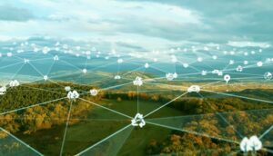
Why use satellite images for impact measurement?
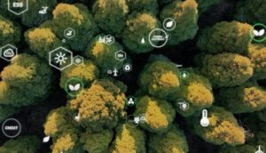
The foremost benefit of satellite imaging for impact measures is its objective, independent, and impartial nature. It helps to overcome limitations of surveys or government census based impact measures which rely on subjective perceptions and self-reporting. Data is obtained remotely through satellite sensors, without any direct human intervention in the field. Second, field based measurement through surveys are complex to carry out, takes a lot of time and quite expensive. Thanks to the advances made in image processing methods, cloud computing and the availability of open access to large collections of data, satellite observations are easily accessible for processing in a matter of hours. This includes Google Earth Engine and The Open Data Cube which are open source and open access platforms that include satellite data collection libraries and processing capabilities. Third, satellite image based impact measurement are ideal for long-term impact measurement. For example, Google Earth Engine offers satellite data for over five decades, which allows to track impact on longitudinal basis, opening pathways for understanding historical evolution of impact. Finally, it offers a global scale for impact measurement, making it more suitable to analyse country-wide and cross-country impact measures.
Current areas of application
The aforementioned benefits has already led to satellite images being used in supporting impact delivery and measurement in contexts such as food security, water access, global warming and disaster management. For example, SatSure uses satellite remote sensing to offer support to farmers and related service providers in India to tackle food security and livelihood issues. At the Socially Progressive Innovation and Entrepreneurship (SPIE) doctoral centre at Strathclyde, we have been using satellite images and machine learning methods to predict probabilistically water point locations in Malawi. Open satellite imagery provided by DigitalGlobe offered critical insights for humanitarian relief efforts during hurricanes, cyclones and floods. Planet offers high resolution images for a variety of applications ranging from precise agriculture to assets monitoring and illegal deforestation and changes in land use.
What’s needed next?
- Open access of high-resolution data: Through governmental programmes such as the EU Copernicus and the US Landsat programme, large collection of satellite data is currently freely available to public. However, they provide low to medium resolution satellite images (60-10 m/pixel) while high resolutions images still needs to be purchased from commercial companies. There is a need for multilateral research consortium and open access data platforms to emerge that would offer and utilize high-resolution satellite data for research and impact measurement purposes.
- Development of advanced algorithms: Though machine learning and image processing methods are being used for merging, processing and analysing satellite images, human intervention is still involved in labelling and in offering supervisory learning support to the algorithms. We need further advancement in algorithms to automate processing of images in a large scale for impact measurement.
- Manufacturing and deployment of nano- and micro-satellites: Currently satellite images available are of lower resolution and lower frequency, which limits the scope for fine-grained measurement of impact at a regional level. The manufacture and deployment of constellations of micro- and nano-satellites, will unlock access to global high spatial resolution data with high temporal resolution (Planet CubeSat constellation).
- Multi-disciplinary research networks to make sense of data: Universities are running dedicated programmes on Satellite Applications and Data Science to train the next generation of engineers and scientists on using satellite images for tackling UN Sustainable Development Goals. However, a narrow approach that is restricted to engineering and technical domain is not sufficient, rather we need more multi-disciplinary efforts that brings together policy makers, third-sector practitioners, and entrepreneurs to make the satellite data meaningful and contextual for impact measurement.
[1] Rawhouser, H., Cummings, M., & Newbert, S. L. (2019). Social impact measurement: Current approaches and future directions for social entrepreneurship research. Entrepreneurship Theory and Practice, 43(1), 82-115.
Editor’s Note:
This article is featured as part of the content for Business Fights Poverty NYC Online 2020, a one-week, online conference (21 to 25 September) that builds on our recent online conference Business Fights Poverty Online 2020 (13 to 17 July) to drive forward connection, conversations and collaboration around how we rebuild better – how together we create an equitable and resilient world. The week consists of inspiring and engaging content, live events, peer networking and community-led learning. The week also builds on our Business and COVID-19 Response with Harvard Kennedy School Corporate Responsibility Initiative, and supported by DFID and a number of our corporate partners.
Each day, we will focus on a specific theme: Imagining the Future We Want (Monday); Creating an Equitable World (Tuesday); Helping People Survive and Thrive (Wednesday); Building Resilient Livelihoods (Thursday); Shaping System-Level Partnerships (Friday).
If you were unable to join these sessions you can access all of the recordings and summaries with a Digital Pass. You can watch the opening sessions and musical performances via the links on the event page.